
The first mention we have of Blaydon is 1256 when an entry in the Northumberland Assize Rolls mentions the Lord of the Manor of Denton complaining that Robert Neville and Everard of Blaydon had destroyed his fish weir on the Tyne. Winlaton coal is mentioned being shipped from Blaydon in 1367 and there was some sort of passenger boat “a great boat” recorded in 1593. The first clear map we have of Blaydon is from an estate map dated 1632/3. Beginning at the site of the modern Swalwell Bridge then known as Selby’s Ford – there was no bridge then across the Derwent – the road from Winlaton Mill ended roughly where Swalwell roundabout is now. There was probably a footpath through the field to Derwenthaugh, although it is not marked on the map. Away to the south stood a large whitewashed mansion, known as the Whitehouse, or Winlaton Whitehouse, and it stood upon Spring Hill, about 100 yards west of the present Axwell Hall. A small wooded park of 31 acres surrounded the house. Beside the road, where the lake is now, in Axwell Park, lay a patch of marshy ground called the Black Meres – lakes or ponds.
To the north east stood Bate House which appeared to be a substantial mansion. Who Bate was and when he lived is unknown but the estate is mentioned in the sale of Winlaton manor in 1569, so presumably Bate lived here before that date. In front of the house was a park stretching across to the Derwent, the road to Scotswood Bridge cutting through the centre of it today. The two ( white painted ) cottages which have recently been renovated were probably connected with the mansion. Behind stood a large field known as Batehouse Close, which is the land on which Blaydon Comprehensive School ( now baths & health centre) stands today.
Next to Batehouse Close stood three large tracts of marshy land named the Strother, Nether Strother and Far Strother, all extending from the Hexham Road to the River Tyne. It was the home of water fowl, many of which were shot by the sporting fraternity of the neighbourhood until the turn of the 20th century.The last water rail being shot here in 1892.
The council has now grassed the area and planted trees around the large pond ( now Shibdon Nature reserve ), which is all that is left of the Strothers. Artificial islands have been constructed in the water and it is hoped they will attract bird life back to these haunts. Across the way on the south side of the turnpike was a large pasture field extending roughly from the Dower House to the bottom of Shibdon Bank. It was called Newfield and it stretched to the top of the hill at Bleach Green. Newfield was divided into two parts by the Winlaton and Newcastle Road which ran up the Avenue, Axwell Park, and came out at the Co-operative Stores at Bleach Green. At the bottom of Shibdon Bank was a small walled enclosure called the Deer Close. The present day cemetery was known as the Sandyhill, or the Hawthornfields, while the land from here on to the bottom of Blaydon Bank was called Greenwell Rigg, or Low Blackstones.
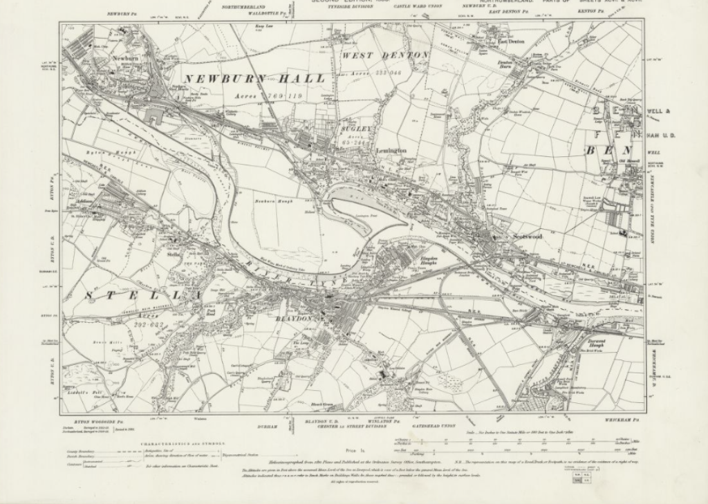
Opposite, where Churchill’s works are now (opposite the cemetery) was Long Gair while the area from the Council Offices to St. Cuthbert’s Church and thence down to the Tyne, taking in Blaydon Haughs, was Sir William Selby’s Haugh, while a plot of land at Blaydon station constituted the Common. On the west side of Blaydon Bank, along to Fountain Lane and from there to March Terrace, now Croftdale Road, the ground was known as Parkins Hill. Finally there was the Horse Crofts and this covered the ground from the ‘Rose and Crown’ public house at Winlaton, with Blaydon Burn on one side and the road to Blaydon today turning off at Chesmond Drive, its other boundary.On the Blaydon Burn from the Brockwell Wood to its junction with the Tyne stood six water mills, three of them extremely close together just where the brickworks are now ( grassy space above bridge – Cowens Low Yard ). This is a picture of Blaydon 1632-33.
By 1760 some big changes had taken place. No longer had the traveller to wade the ford across the Derwent for in its place stood a pleasant bridge with 3 arches, built by the Claverings to ease access to their new stone built house called Axwell the old Whitehouse having been demolished.Bate House had disappeared and a farm built in its place tenanted by Edward Mallabar – so the fields came to be Mallabar’s Close. The Strothers retained their name. Across the road the Black Meres and part of Newfield had been incorporated into Axwell Park, the Dower House had been built and the road to Winlaton no longer ran up the Avenue but had been transferred to where it runs today, Shibdon Bank.Opposite the entry to Blaydon Cemetery stood Low Shibdon Farm.Blaydon Bank formed part of Sir William Blackett’s Lead way along which the lead was carried from the mines at Allenheads to the smelt mill at Blaydon, which stood on the site of the present railway station. The only houses on Blaydon bank were two cottages at the entrance to Loup Farm. At Blaydon Haughs near to the crossings stood a windmill. There were houses on both sides of the road near to Fountain Lane, mainly occupied by keelmen. The little bridge over Blaydon Burn was built in 1778, the new road bridge being built in 1936.
From William Hutchinson 1787:
The wharfs at Stella and Blaydon receive the greatest part of the lead which comes down the Tyne.The proprietors are the London Lead Company, the heirs of Sit Thomas Blackett, Bart. and Henry Errington esq. and Company. The smelt mills are chiefly on the Derwent River at: Whitefield, Jeffreys and Acton belonging to the London Company: Dukesfield, Allenheads nad Rookhope, belonging to the heirs of Sir Thomas Blackett:Feldon near Edmondbyers belonging to Mr. Errington. Sir Thomas’ heirs have a refinery at Blaydon.The yearly receipt of lead at the above wharfs is 60,000 pieces of twelve stones each. There are ninety three carriages constantly employed to bring down the lead, each carrying ten pieces at a time. The average number of pieces of lead sent to Blaydon from the western mines, in the County od Durham, is about 100,000.At this time Blaydon bank was known as Silver Hill because the pack trains carried lead down it from Winlaton to Blaydon and every ton of lead produced nine or ten ounces of silver.
The lead was carried down to Blaydon in the early days of the eighteenth century by small galloways containing a piece of lead on each side. The leading pony had a bell attached to its head in order to guide those behind. It would have been a common sight to see forty or fifty galloways, in the charge of two men, making the journey from Allenheads to Blaydon. After the roads had improved, later in the century, a horse-drawn vehicle called a wain was used. This was done during the summer months only – as being the only time when travel was possible, but as the men were farmers and had their own farming work to do in the summer as well, this lead to supply problems.
The London Lead Company had a wharf at Stella, and the road was called Lead Gate. The route was over Hedley Fell to Lead gate, where the ponies were changed; then by road by Coalburns, Greenside and Path Head to Stella. The lead belonged to the heirs of Sir Thomas Blackett, was refined at Blaydon and then shipped to its destination.
Every ton of iron ore produced nine or ten ounces of silver. The lead mines at Alston & the refinery at Blaydon were later owned by Colonel & Mrs. Beaumont.
The distinction between a wain and a waggon: a wain is only used on the road whereas a waggon ran on rails.
By 1828 some other industries had begun here:
William Hawdon: Iron foundry
Emmerson & Milner: Iron & steel foundry & brick manufacture
Beaumonts: Lead yard
There were 8 public houses, including: Bee Hive, Grey Horse, Half Moon, Queen Caroline, Red Lion.
Blaydon House had been built & was occupied by John Mulcaster agent to Thomas Richard Beaumont.
Keelmen were still the most numerous class of workmen occupying most of the houses.
By 1835 the lead works at Blaydon had ceased to operate and on its site stood the railway depot, now the station. Most of the staithes had disappeared, as the railway had cut off access to them.
1850’s saw the big expansion of Blaydon with many more industries and the consequent increase in housing. Blaydon Main colliery opened up again in 1853 & Cuthbert St & Robinson Street were built to house the miners. Gas lighting began 26 November 1853.
From:
History of Blaydon by Winlaton History Society 1975
History of the Parish of Ryton by William Bourn 1896